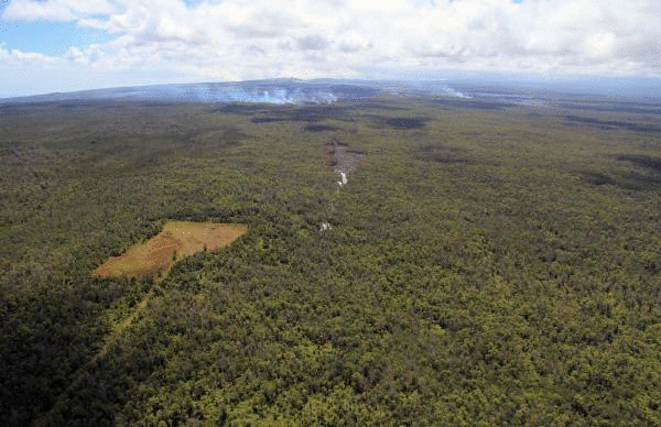
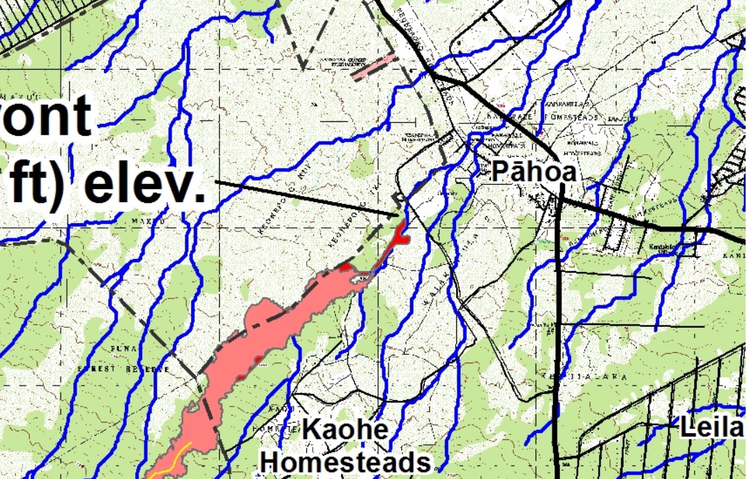
The “thing” is namely the “June 27th flow” ( that’s when it started ) of Kilauea on the big island of Hawaii. This flow seems unusual because it is a very thin tendril that has been “guided” by a long crack in the ground, forming an extended lava tube of about 10 miles length, as shown in this Sept 15 map. ( Click to enlarge. )
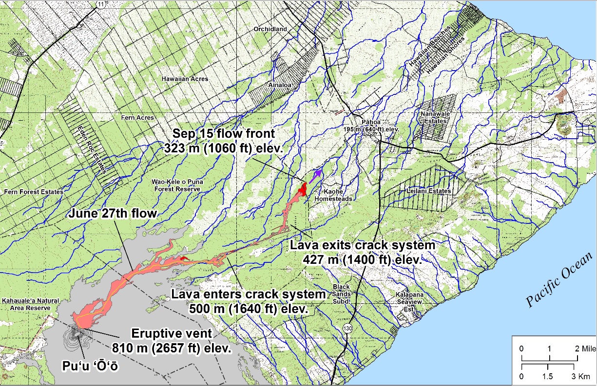
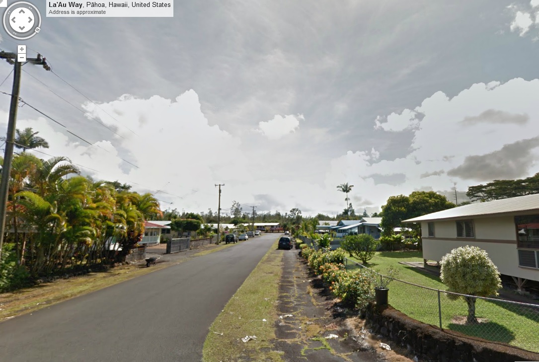
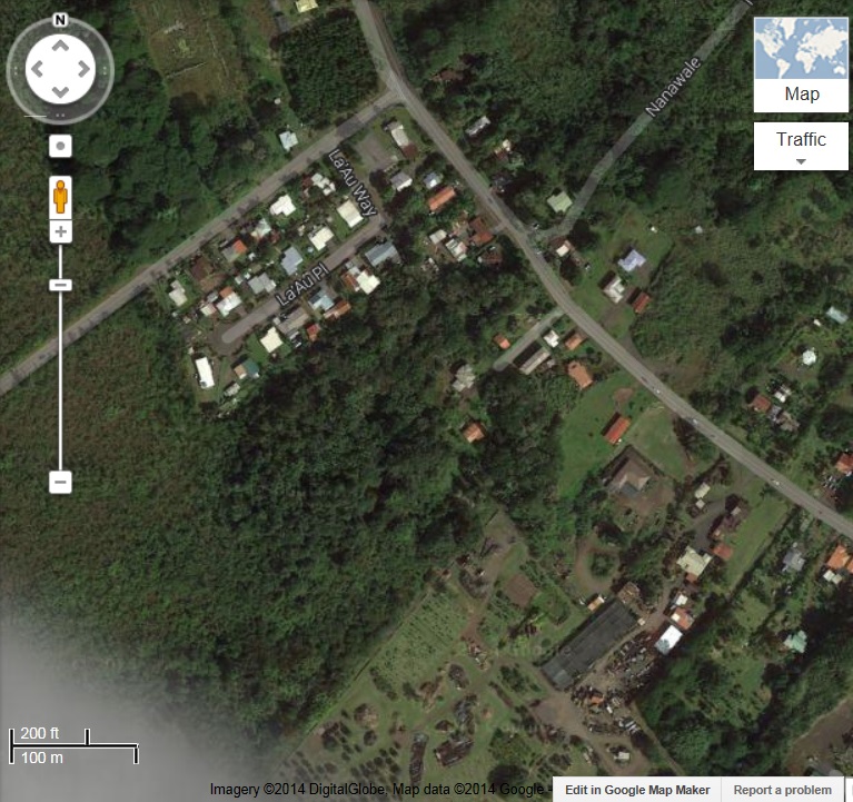
It looked for a while like it was headed for the Kaohe Homesteads, but then it spilled out of the crack and bypassed them, following the fall line of the land. Fall lines are shown on the map as blue lines, like streams. Now it looks like it is headed right for the town of Pahoa, which resembles a “shore town” in that it is pretty much built along a single thoroughfare, route 130. It’s projected to reach that road in about 10 days, and following the fall line it’s on, I see ground zero at this small block of homes, shown in Google Maps Street View.
The official projection is something around there, but I couldn’t quite decipher it. It seems the only hope would be for it to stop, but it has been going for a month or so now and it’s hard to see that happening.
Here’s an animated gif view of the approaching “thing” in the form of a plume of smoke wending through the forested landscape. It’s a little hard to follow because the POV shifts backward as it advances. It starts as it advances along the “crack” and ends as it’s bypassing the Kahoe Homesteads.
UPDATE:
Here is the official projection of the flow into Pahoa.
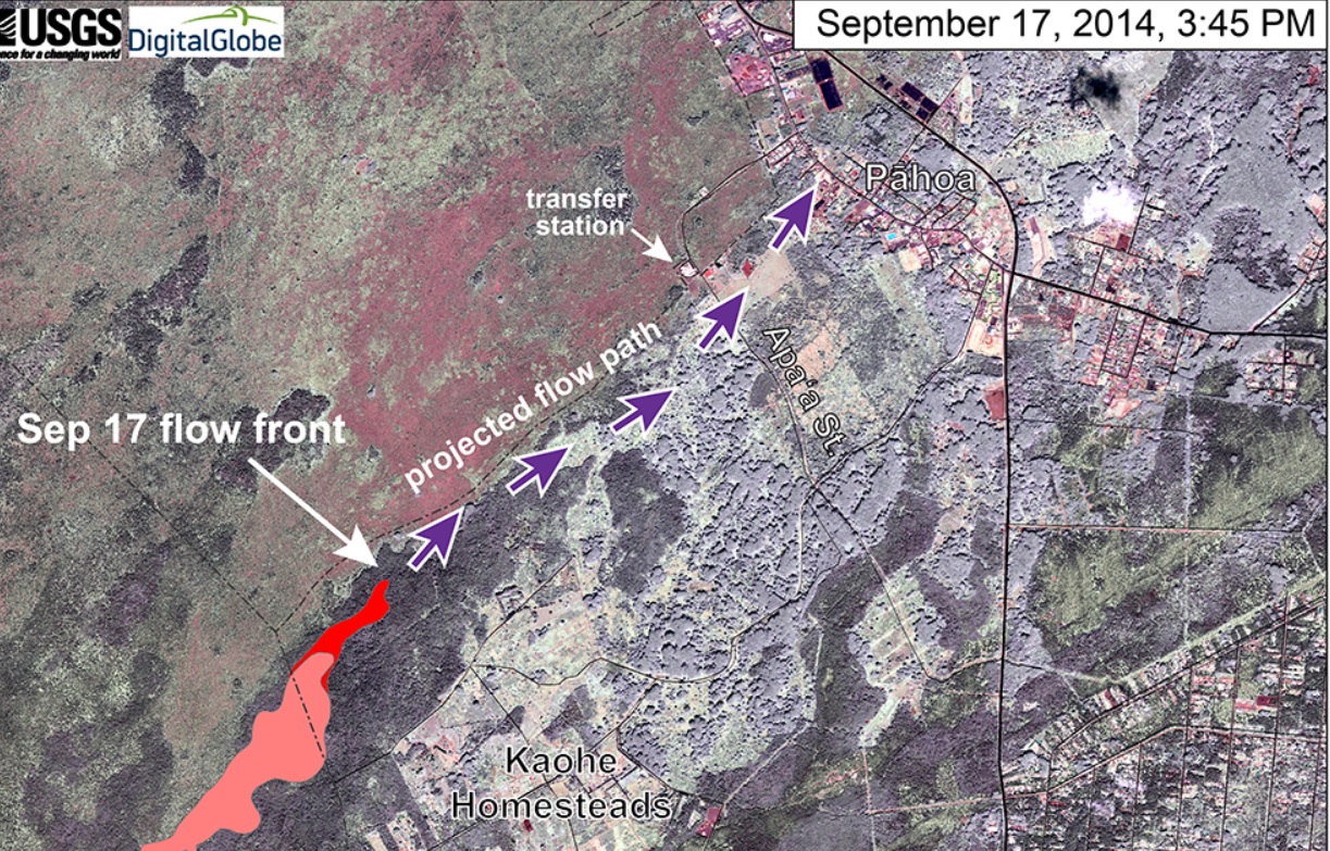
It is very close to what I thought, which is after all just a matter of following the downward slope. Of course it remains to be seen if the flow itself follows this simple projection.
In the following Google Maps view, the street view I showed above is looking southwest along La’Au Place. The projected path in the satellite view is just south of that, on the other side of the grove of trees. Note the the dark rectangular roof visible in both views.
UPDATE Oct 24, 2014
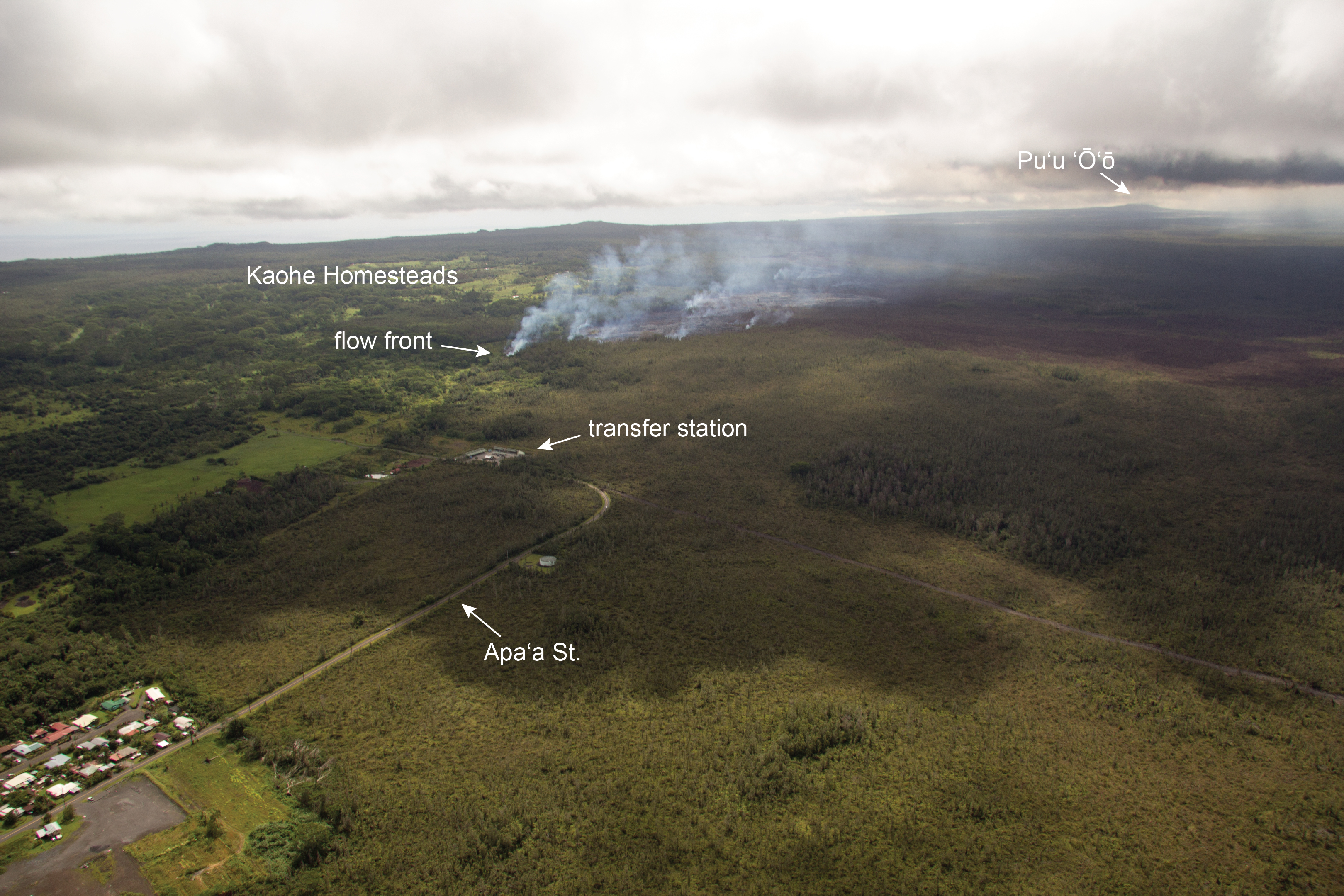
After a seeming stasis, with little advance through most of October, the flow front has reactivated in the last few days: ( click to enlarge )
It has come within a few hundred yards of the “transfer station” ( a recycling drop-off ) on Apa’a St. on the outskirts of Pahoa, so it seems like some sort of incursion is imminent. ( click to enlarge )
Update Oct 26, 2014
It didn’t take long for the flow to cross Apa’a St. (click to enlarge )
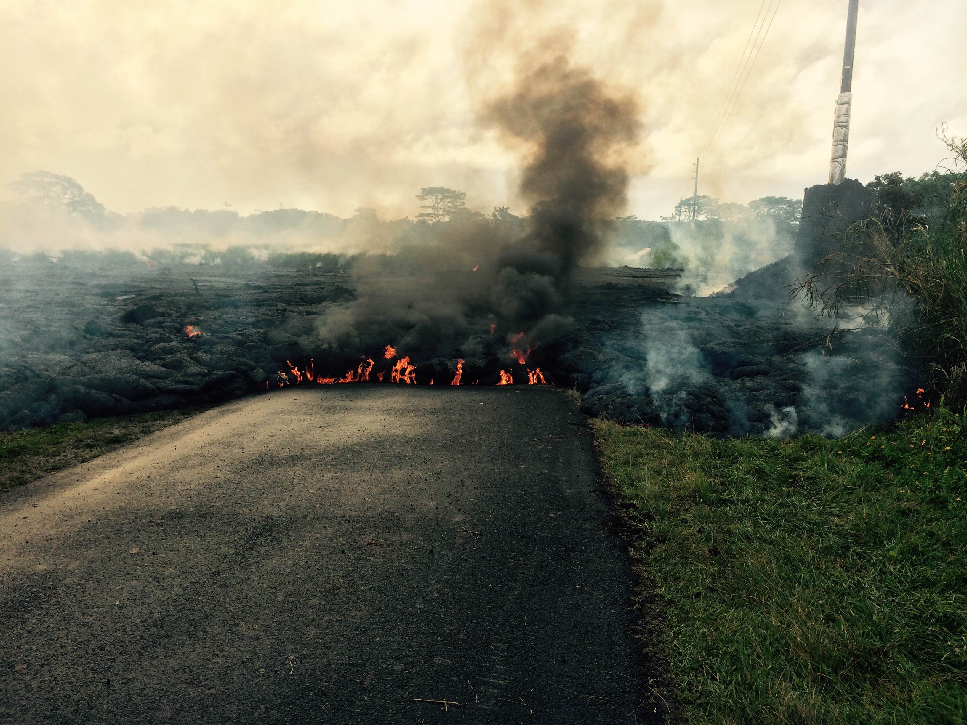
It’s headed for the cemetery, of all things, and going down the cemetery road. Crossing this street has made the news, and brought out the comments: e.g. “What do you expect if you live on the side of a volcano.” Let us not focus unduly on the ignorance of the commenter. This is the way the news operates. Everything is in the abstract. Details are presented without context, so this sort of interpretation is to be expected. OTOH we may note that the presence of a cemetery on the line of flow suggests that this event is without precedent in living memory. A brief perusal of the maps of this flow backs this up. It is very unusual in its nature and its direction of flow.
Well, Kilauea is there, and I think the residents are duly philosophical about living next to it. It’s a very narrow flow, and they may have reason to hope that it will stay narrow as it cuts a path to the sea, and remain in the nature of a temporary disruption.
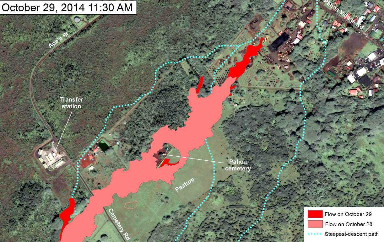
Update 10/29/2014
Are you superstitious ? I hope not … because I may be!