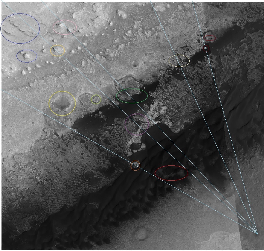
Here is a Hirise based view of the scene to the southeast of the Curiosity Bradbury landing site. ( South to the top. ) The colored ovals show landmarks discernible in the Sol 3 Mastcam panorama discussed in an earlier post.
The “river” here is the long depression at the base of Mt. Sharp running from SW to NE. I don’t believe it is a candidate for an ancient streambed, but it has the subjective appearance of a river valley on earth, especially because of the dark blue sand dunes which cover its bottom. This view to the SE is towards its closest approach to the landing site, and there is a conspicuous “Island” along the leftmost line of sight, marked there in an orange circle. I think of it as “Ellis Island”, in honor of Curiosity’s Martian Immigration … it sure ain’t coming back!
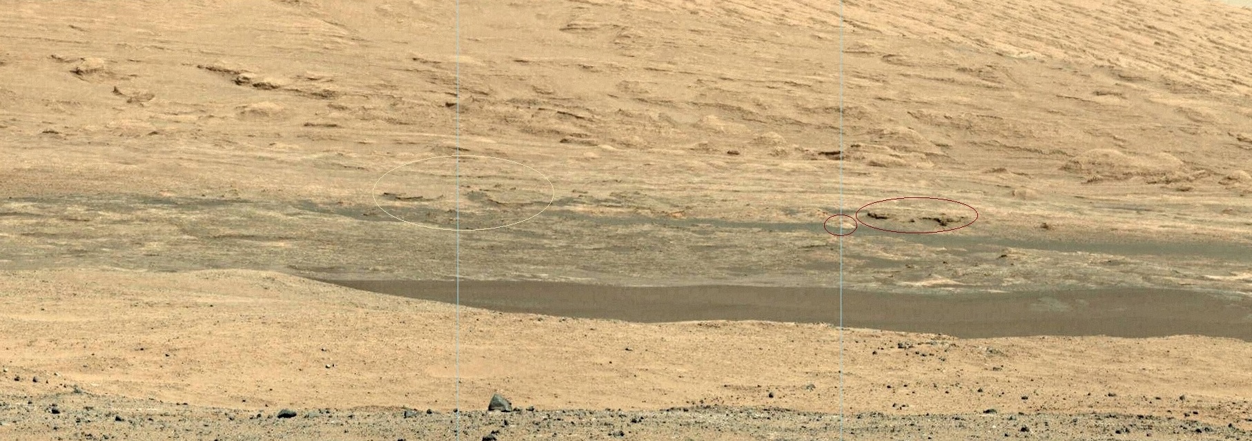
Below are two overlapping sections of the SOL 3 panorama, extending to the SE from the previously posted section. Of course the colors of the highlighted features there correspond to the Hirise view above.

Of note is the “invisible mountain” circled in orange-yellow, above the purple-circled “strait” . Can you see its outline in the panorama? Of course, it is readily visible in the Hirise view, and this threw me off for a while.
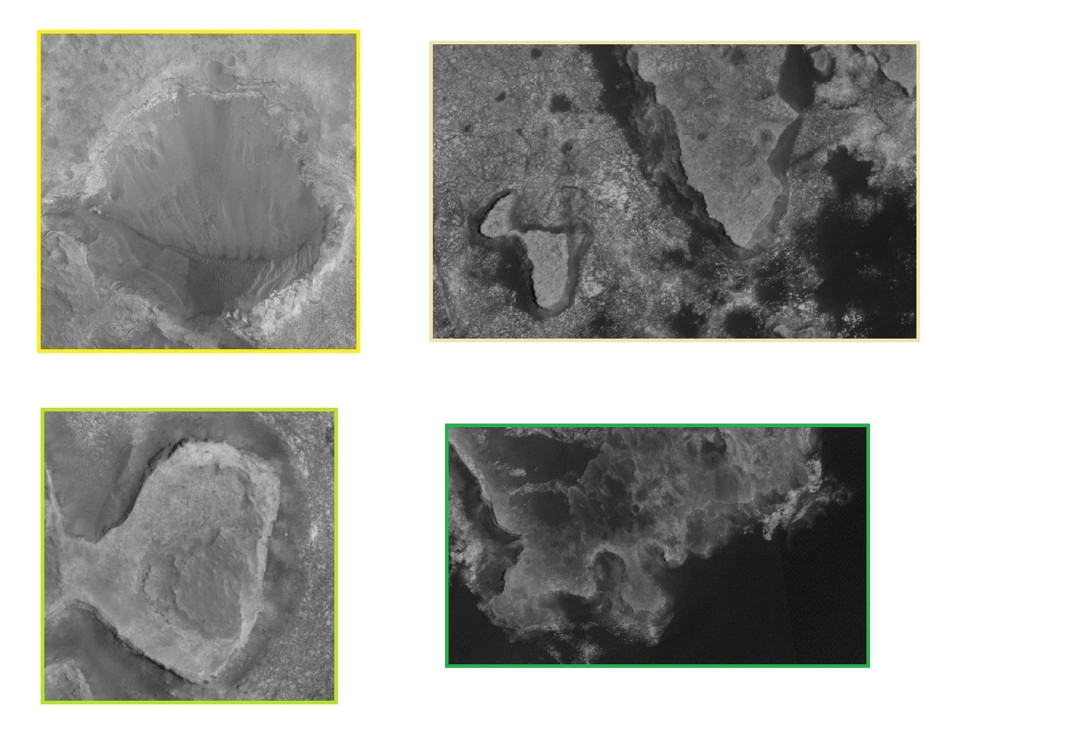
Finally, I include below some Hi-res Hirise views of selected features, as indicated by the colored borders. The High resolution view is very helpful in discerning vertical relief which might correspond to appearances in the panoramic view. All in all, a difficult and fretful business, to which I have now devoted a number of hours!

