The MSL website helpfully provides maps to show the progress of Curiosity, but lately, circumstances have led to some frustration.
Curiosity has reached the southern limit of the displayed range, and it is heading south, so it is hard to see what is in store. In addition, the large scale inset is placed so that it obscures significant adjacent topography … as shown here …
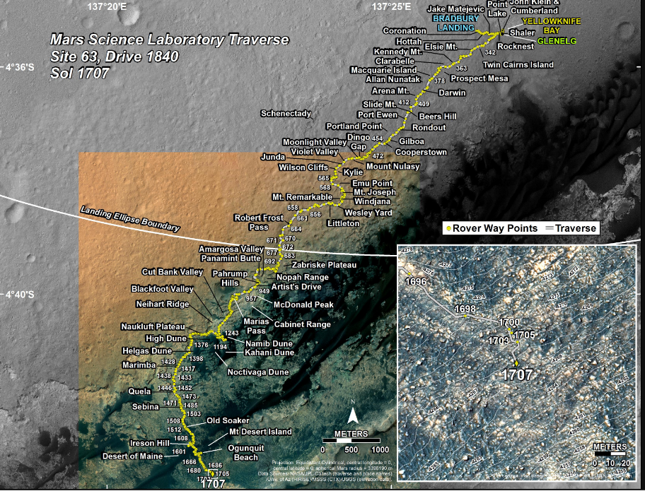
Never fear! I have the Hiview software and image files, which I downloaded some time ago, and these include the imagery that is the basis for these maps. So here I display a small scale ( … N.B. a small scale displays a large area … ) image with the approximate boundary of the sol 1707 inset map marked.
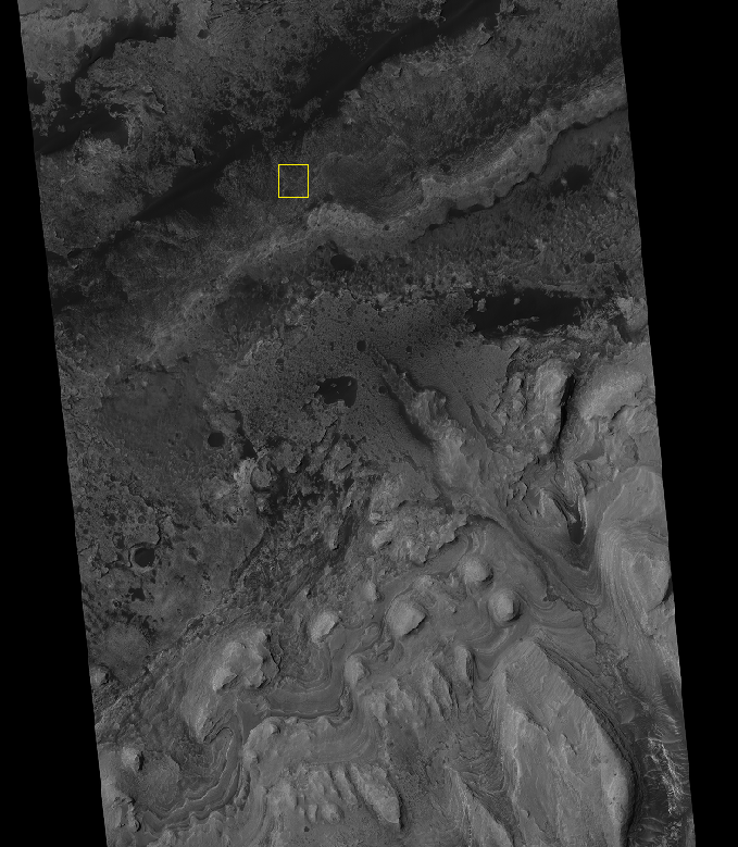
You’ll note that the “foothills” of Mt. Sharp are well distant to the south. The features there were evident in the panoramic views from the landing site, as see my Sol3 panorama post from Dec 5,2012. ( This was my first Mars Curiosity post. )
Curiosity is more than halfway there from the landing site, but I’m not sure what the schedule is, or the planned path.
“Hills peep o’er hills, and alps on alps arise!”