During this several months trek of Curiosity, I have noted how difficult it is to track its progress by viewing the raw image gallery. It seems that the progress of a hundred meters or so completely changes the perspective of the near and mid ground, so that it’s difficult or impossible to place the future or past position of Curiosity in the images made on successive sols.
Nevertheless, it is always rewarding to review these images, and sol 426 presents some very interesting vistas, which do illustrate the problem I mention, since it seems that there was a displacement during that sol between two sessions of image taking.
First of all, there was a series of 22 images from the Mastcam which form a nearly 360 degree panorama encompassing a high resolution view of the “riverfront” as I think of the edge of the low lying dune fields fronting Mt. Sharp, since this is what its appearance suggests.
You can click on it, and it is not too unwieldy, since it is skinny. If you pan along it at full size, it’s just rocks, rocks, rocks! But that’s Mars. You can see a lot of detail, as Curiosity is much closer to the “river” than it was at Glenelg, and this is very exciting, if you’ve been following the mission.
These images were recorded around 2013-10-17 19:35:44 UTC, and make an interesting comparison to a lower resolution, or really lower magnification, Mastcam view made around 2013-10-17 23:24:38 UTC, so about 4 hours later, apparently after another short traverse. Here is that view.
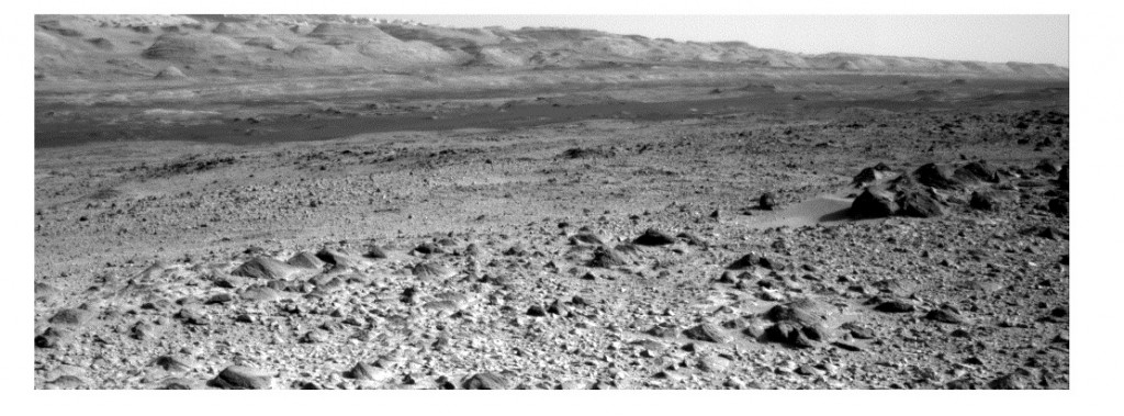
If your anything like me, you’ll find it very difficult to correlate these two ( composite ) images, taken just hours apart. There is a link, though, in several NAVCAM images taken around the same time as the second, smaller, panorama. Here is a portion of one of them, truncated to emphasize its correlation with the panoramas.
Now here is an approximate overlay of that same NAVCAM image, further truncated, on top of the second panorama, which was reduced in scale to match ( at full size. )
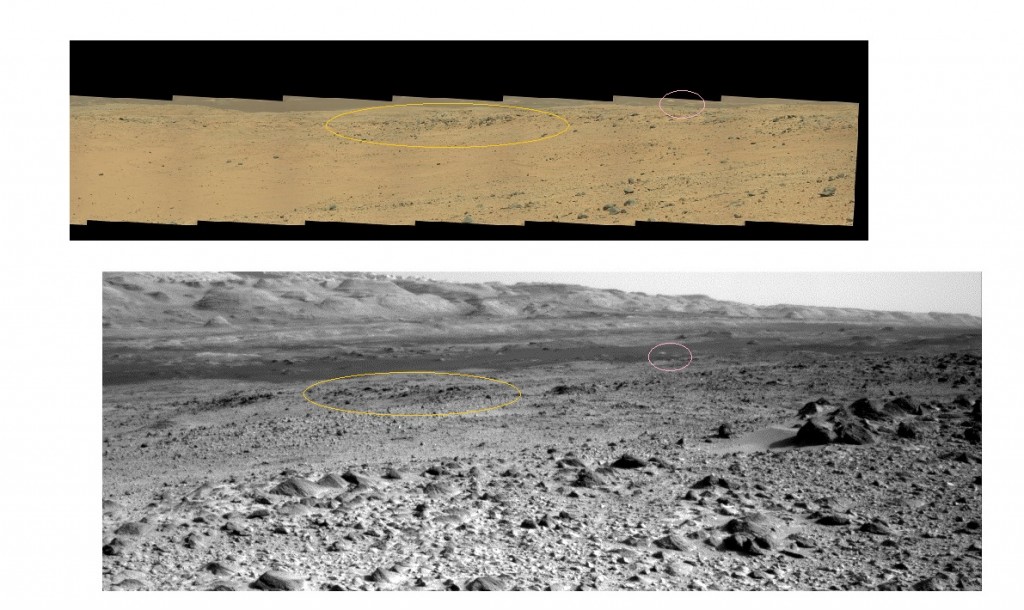
Finally, here is a side by side comparison, again with the NAVCAM image at the same scale, with the high magnification panorama. I’ve marked some correspondences, as I see them, but note these are distorted by the displacement in position between the acquisition of the images. I would just comment that you would never spot this correspondence with a casual perusal, since you would naturally try to correlate the foregrounds of both images.
Well, there’s more where that came from! So … later.


