In search of “Bloodstone Hill”

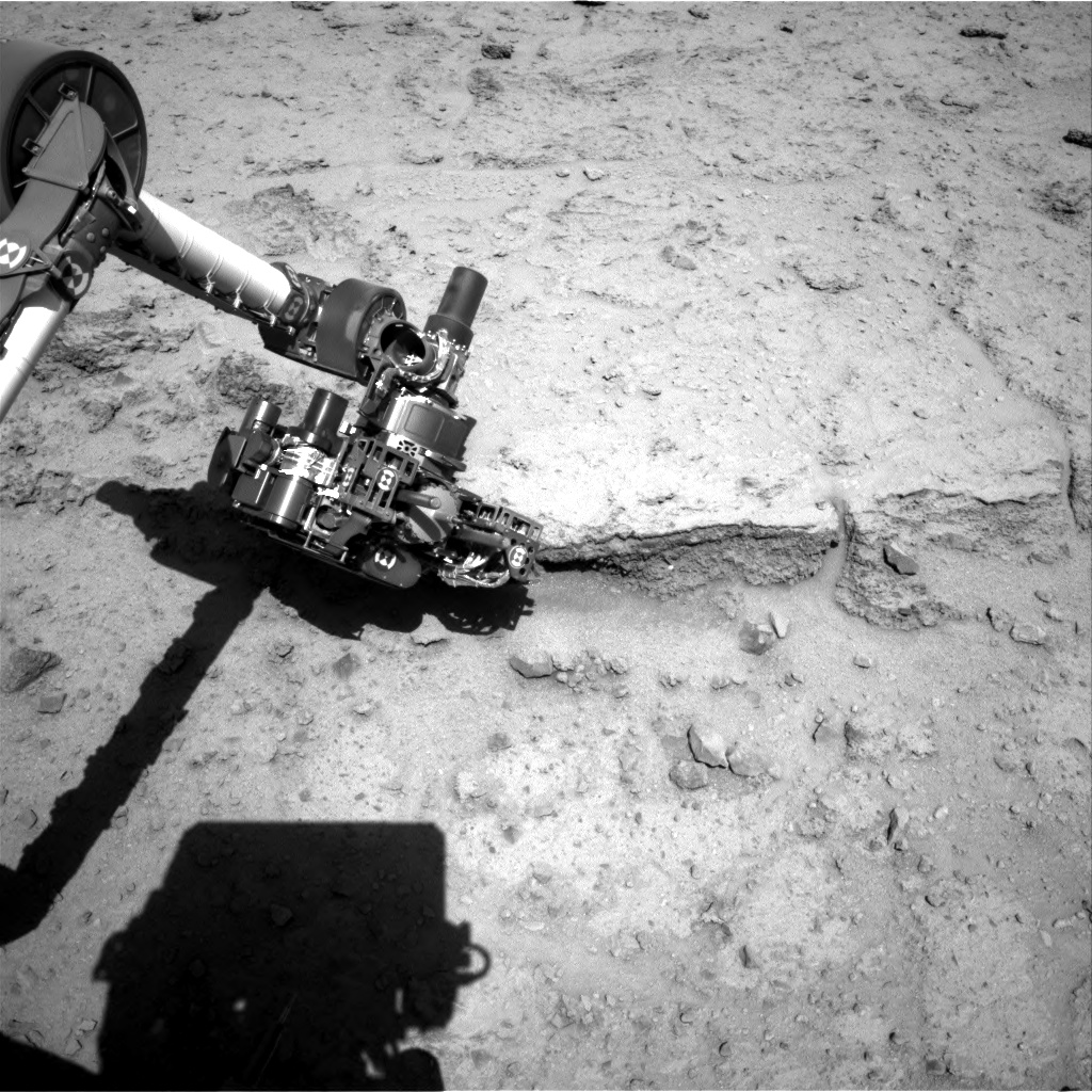
The Mars Curiosity Mission Update for Sols 1954-1956 includes the stated goal of … an RMI mosaic of “Bloodstone Hill.”

RMI stands for “remote micro-imager” and refers to the use of the ChemCam camera for simple image acquisition, without sectroscopy. It has a long focal length, so it makes a fair “spot zoom”.

Then the Mission Update for Sols 1955-1957 is titled,

Sol 1957-1958: Onward towards gray patch

and features this image: 
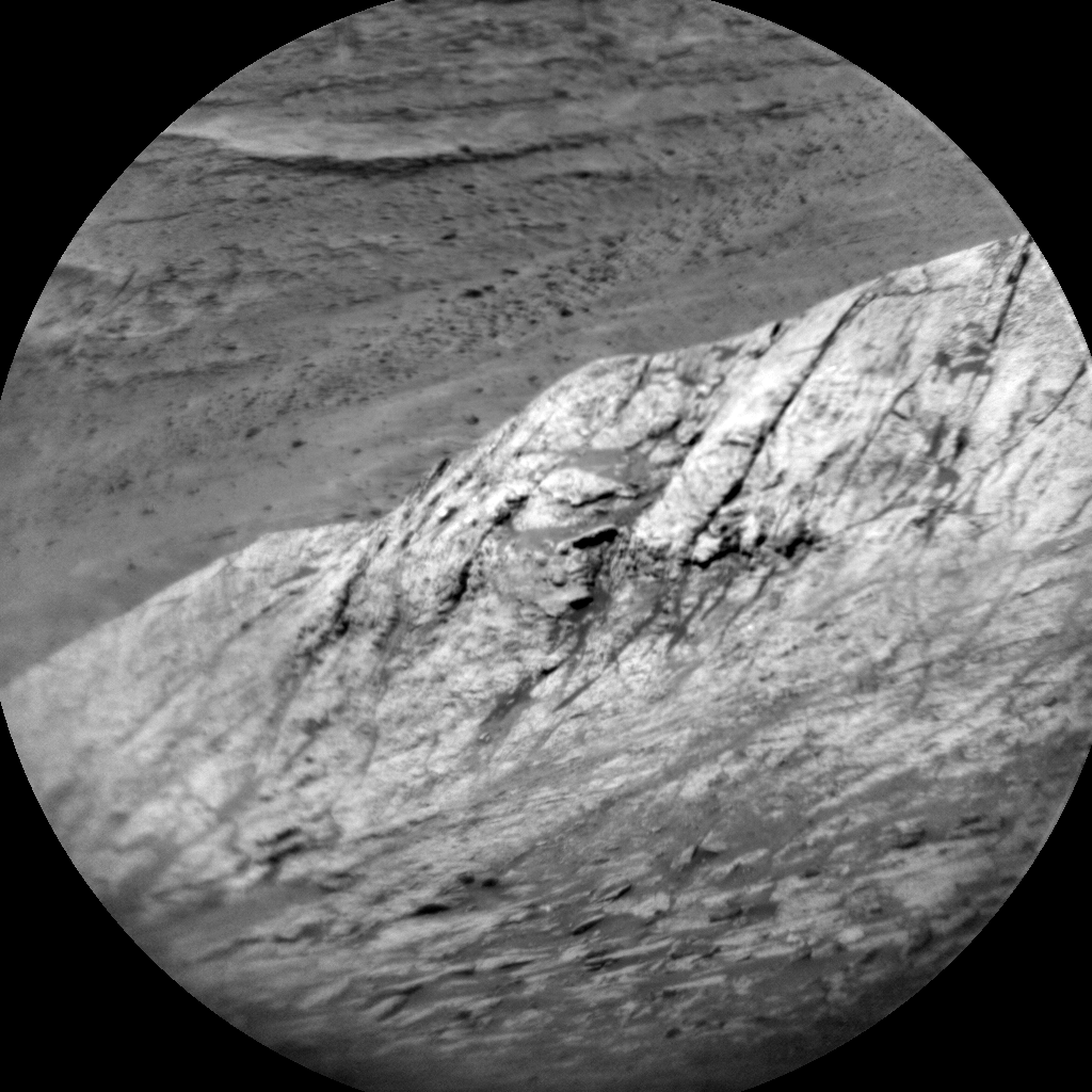
… so I thought for a long time that this was “gray patch”. I don’t want to put anything on the Curiosity Team. The principal goal is not to explain everything to ME. If I have to work a little bit for it, so be it.

The text does say,  inter alia, “… We’ll also take a Mastcam mosaic of “Bloodstone Hill,” another target from the weekend plan that warranted further investigation – this area is featured in the black and white RMI image above. ” OK.

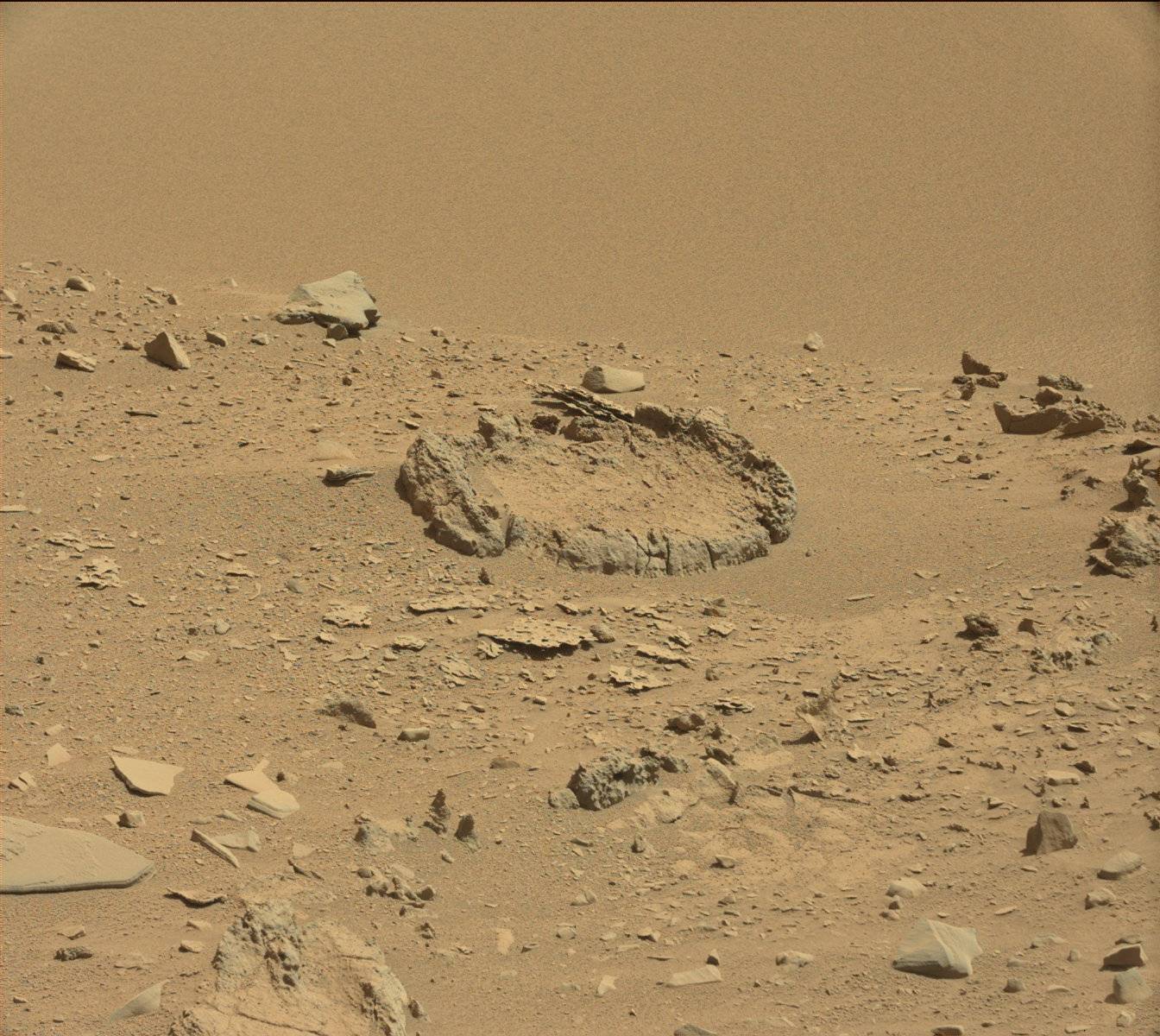
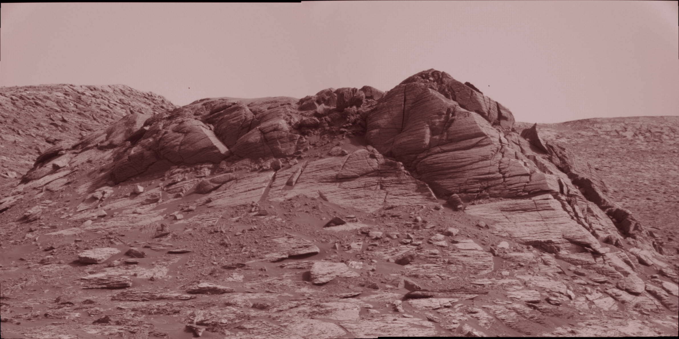
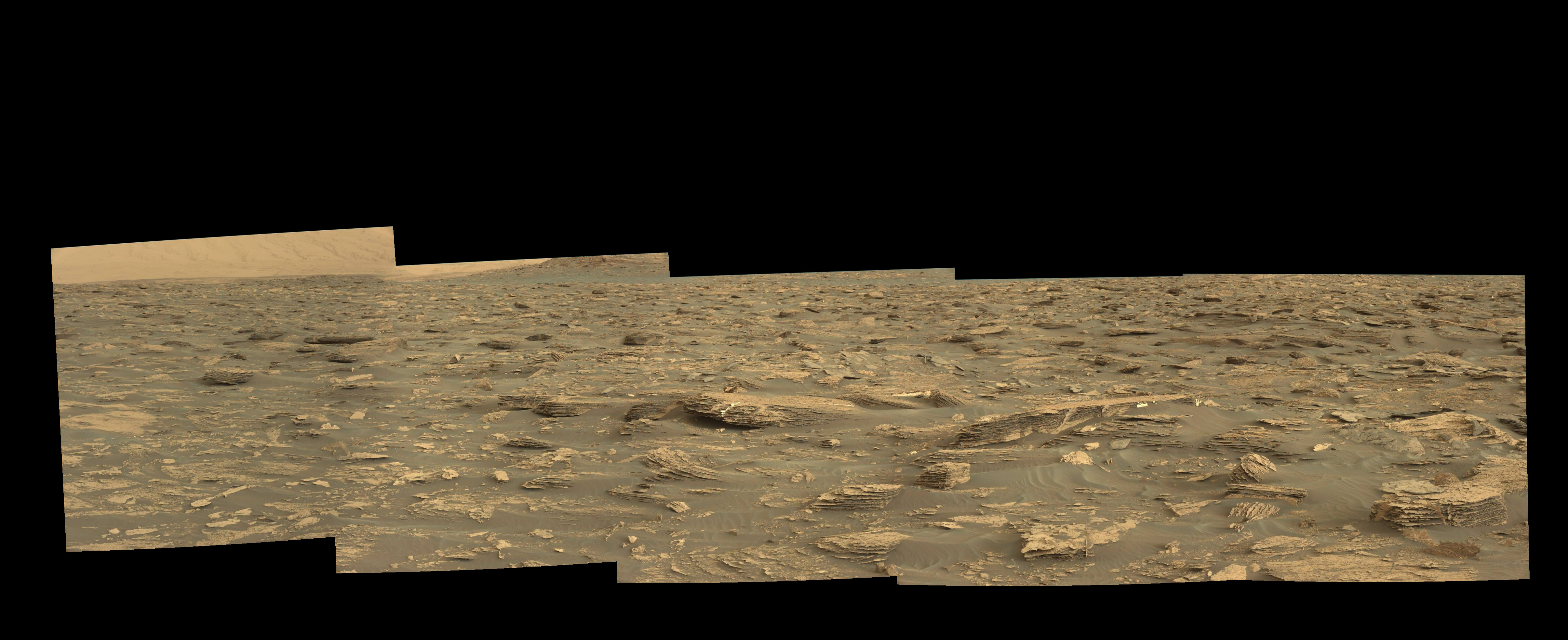
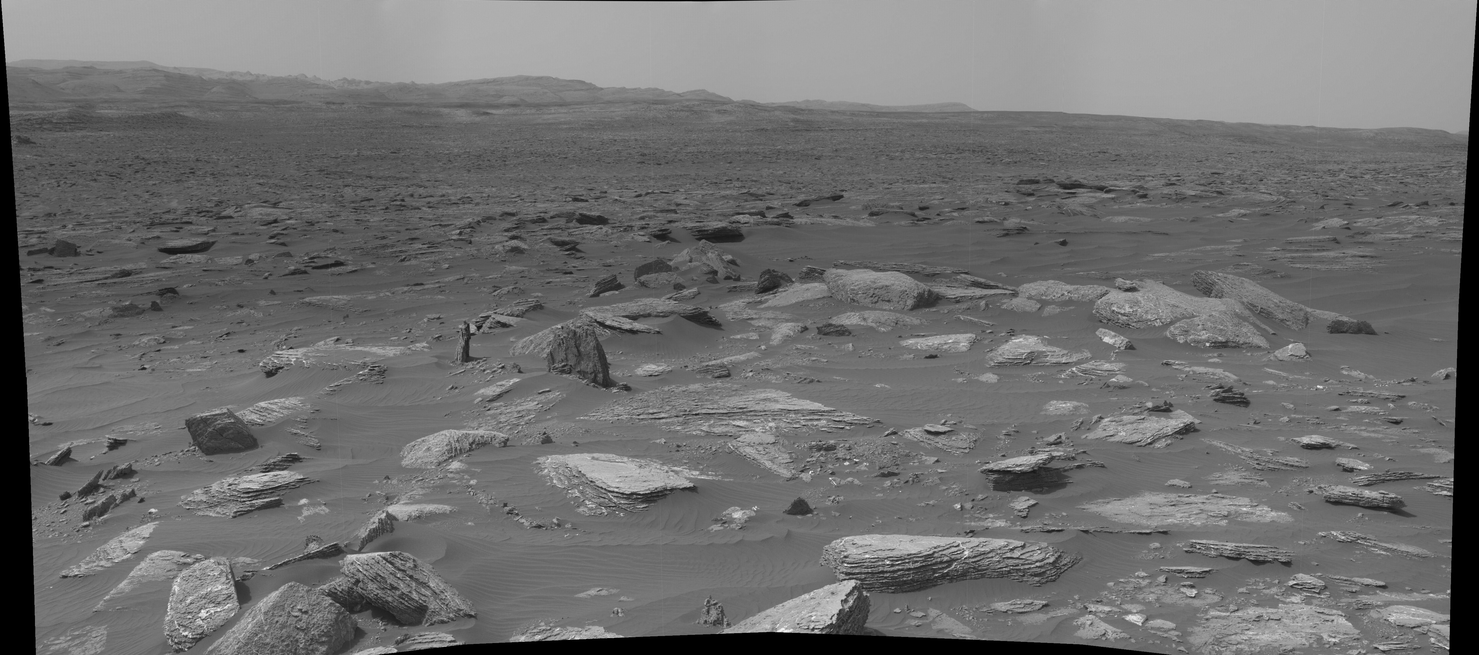
I made the RMI mosaic from sol 1955 ( including the above image, ) and here it is:


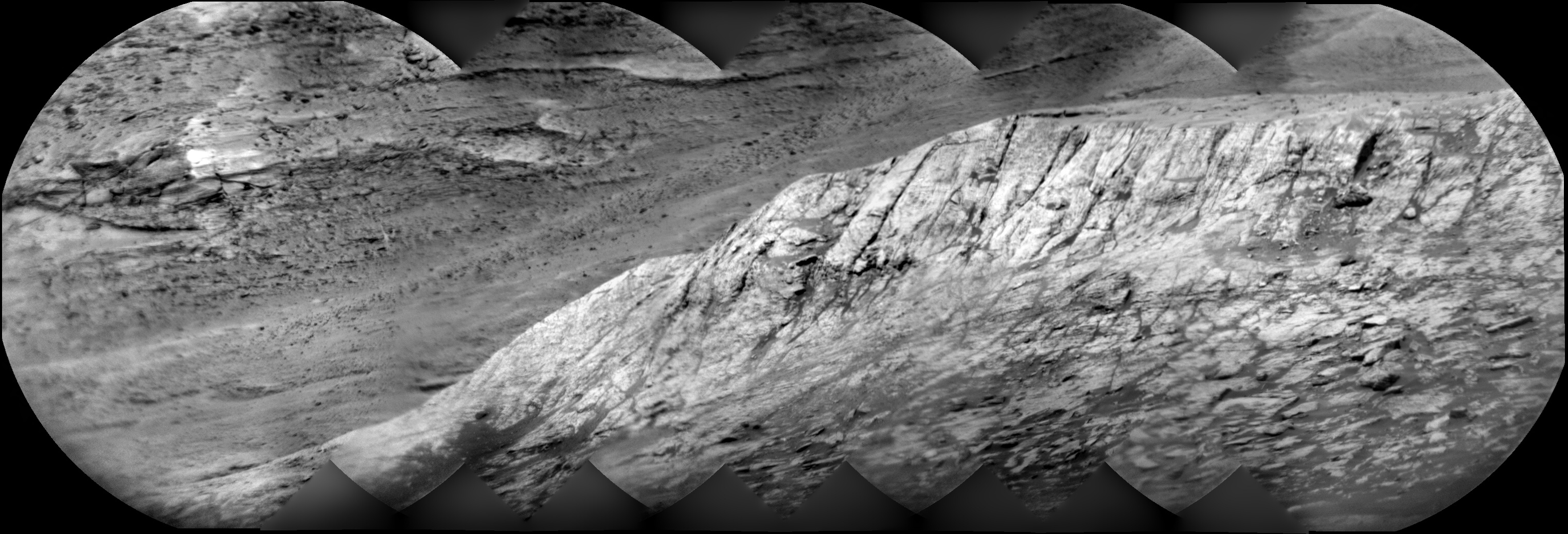
I thought the circular framing would interfere with the mosaic, but the long focal length and narrow FOV kept the stitching very nice.

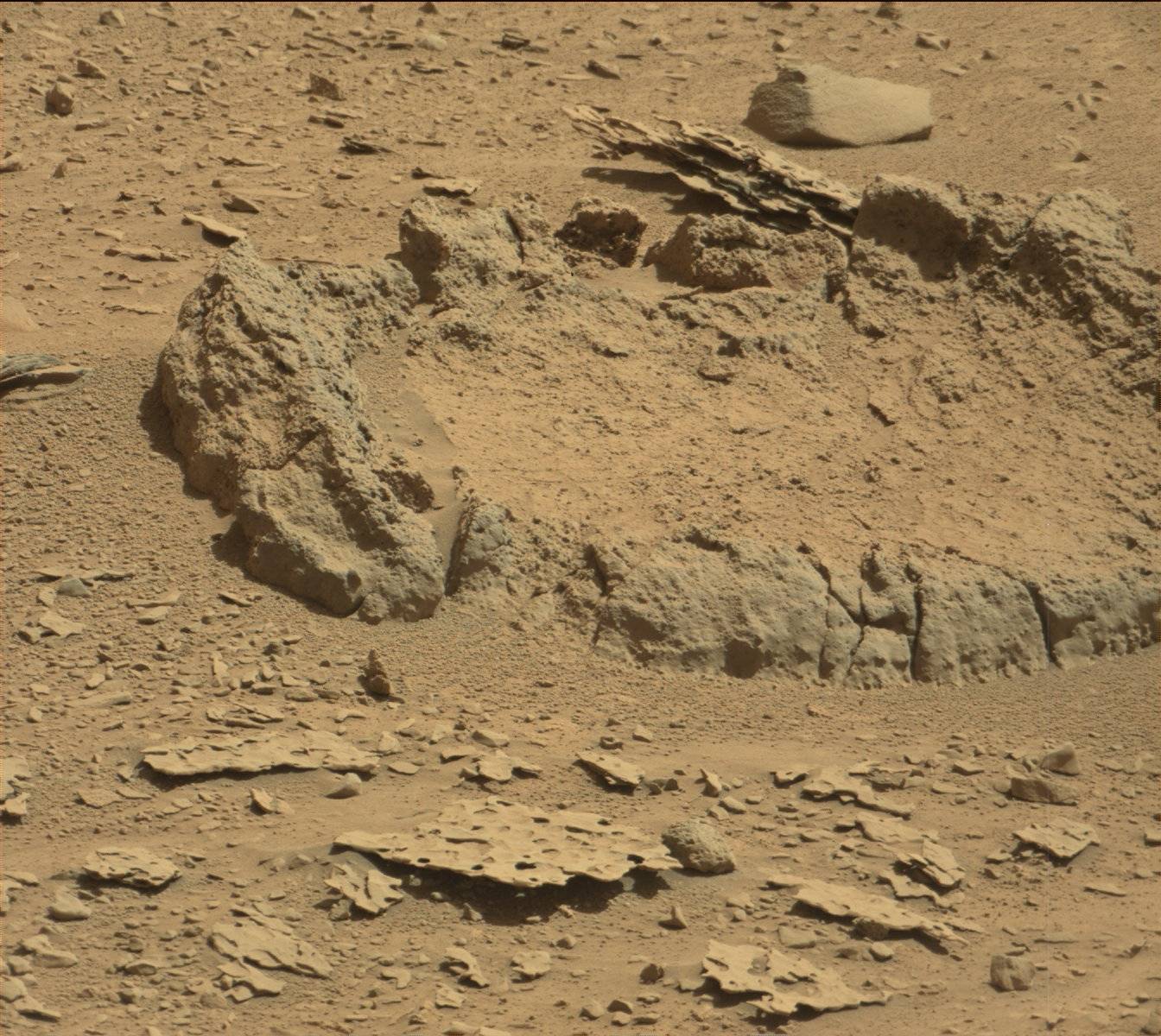
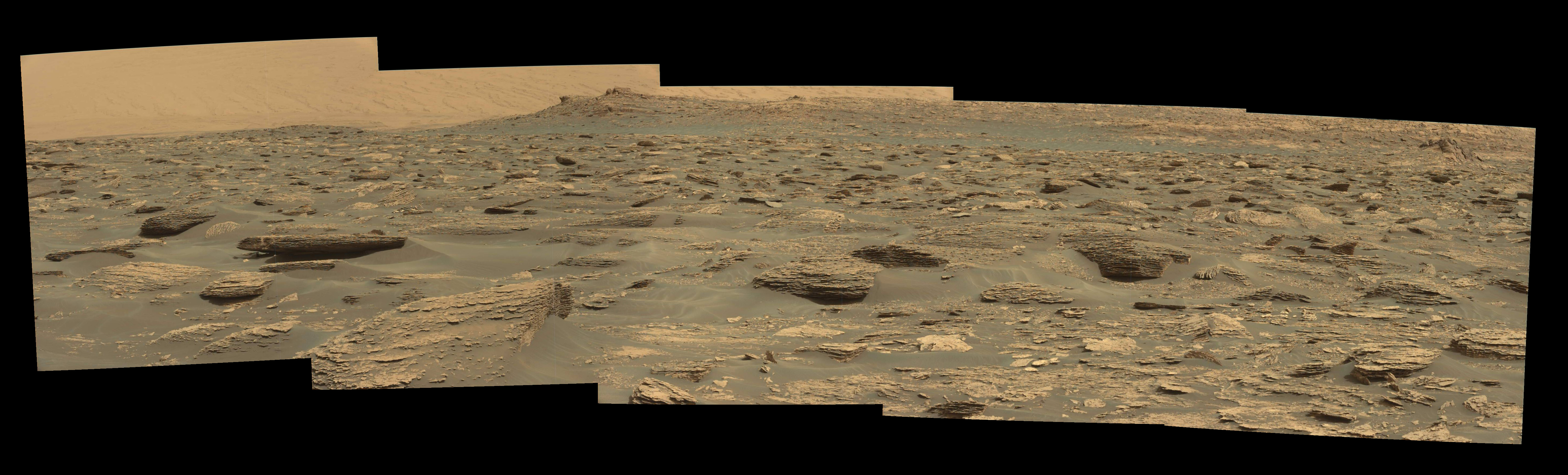
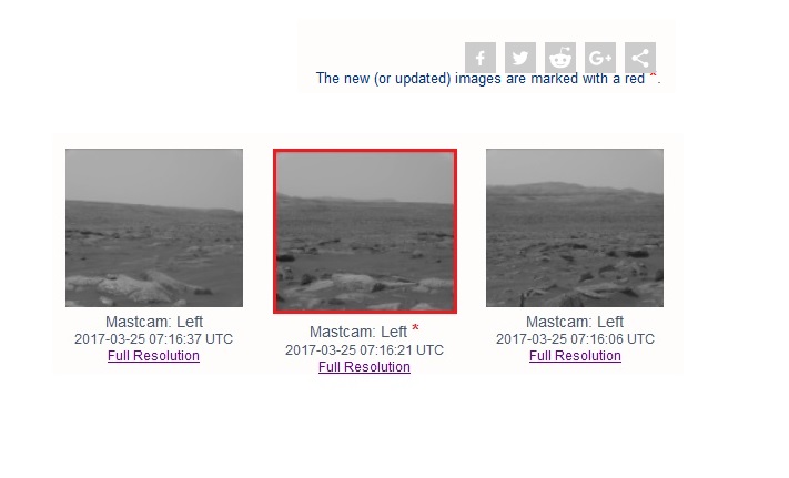
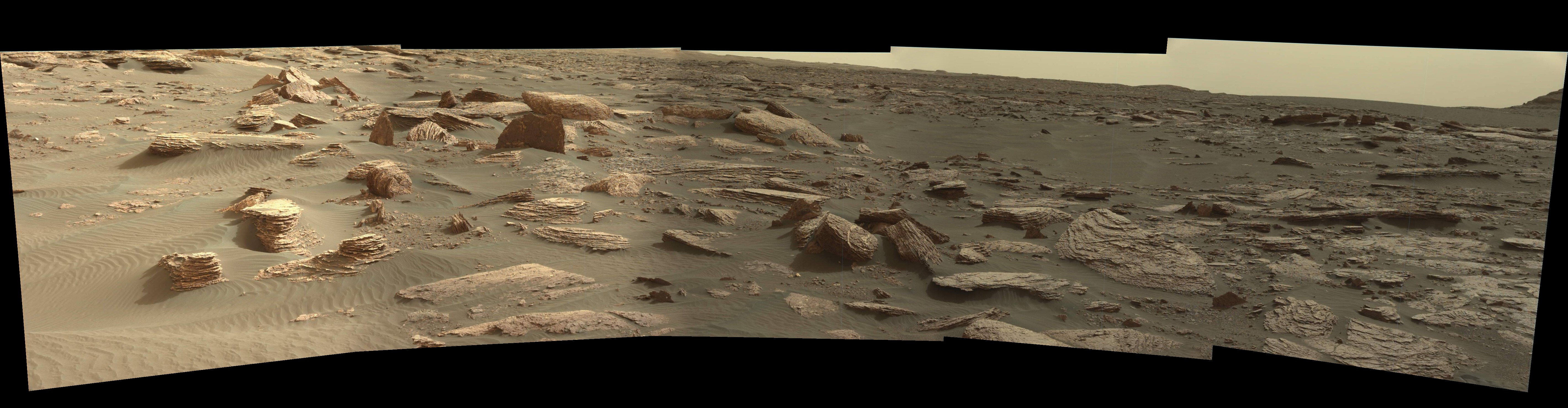
So where is it? What are we looking at? For the promised Mast Cam mosaic, I only found two images in the very annoying rastered grey rendition. Here they are side by side with a “tetch” of Gaussian blur, and some contrast enhancement:

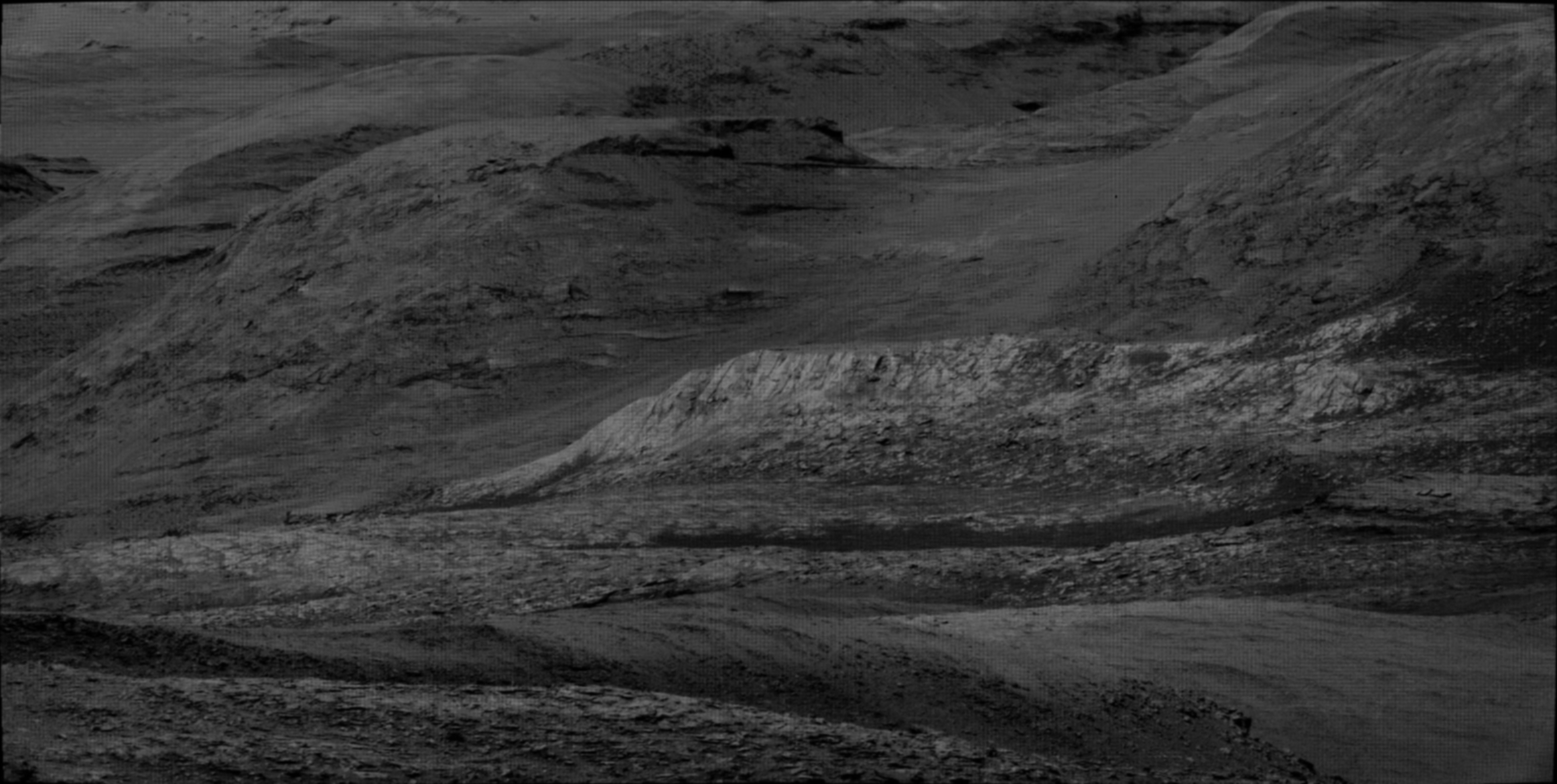
OK! Great context! … except I still couldn’t place this in a broader scene. Note there is no skyline! This makes it difficult.

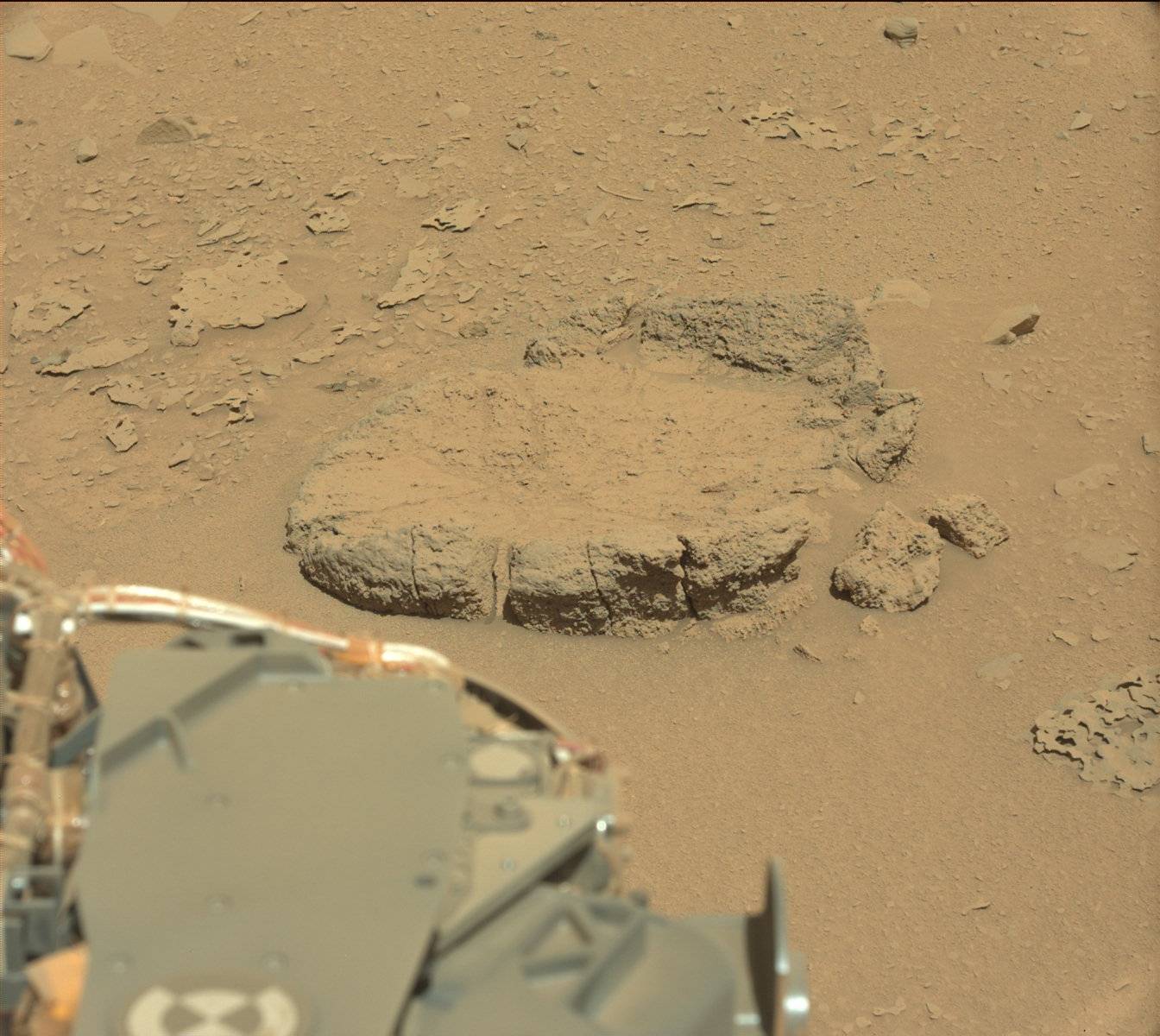
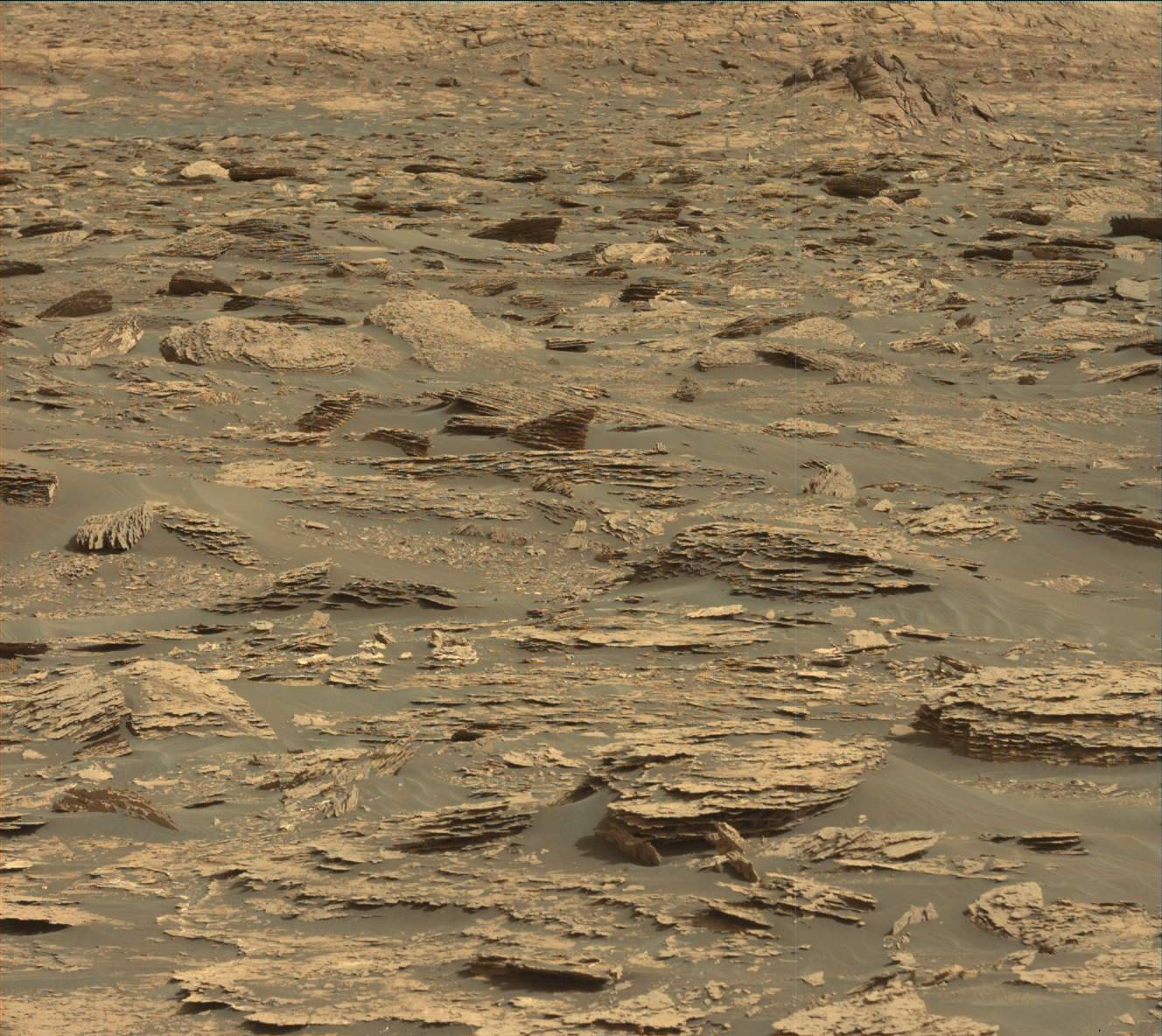
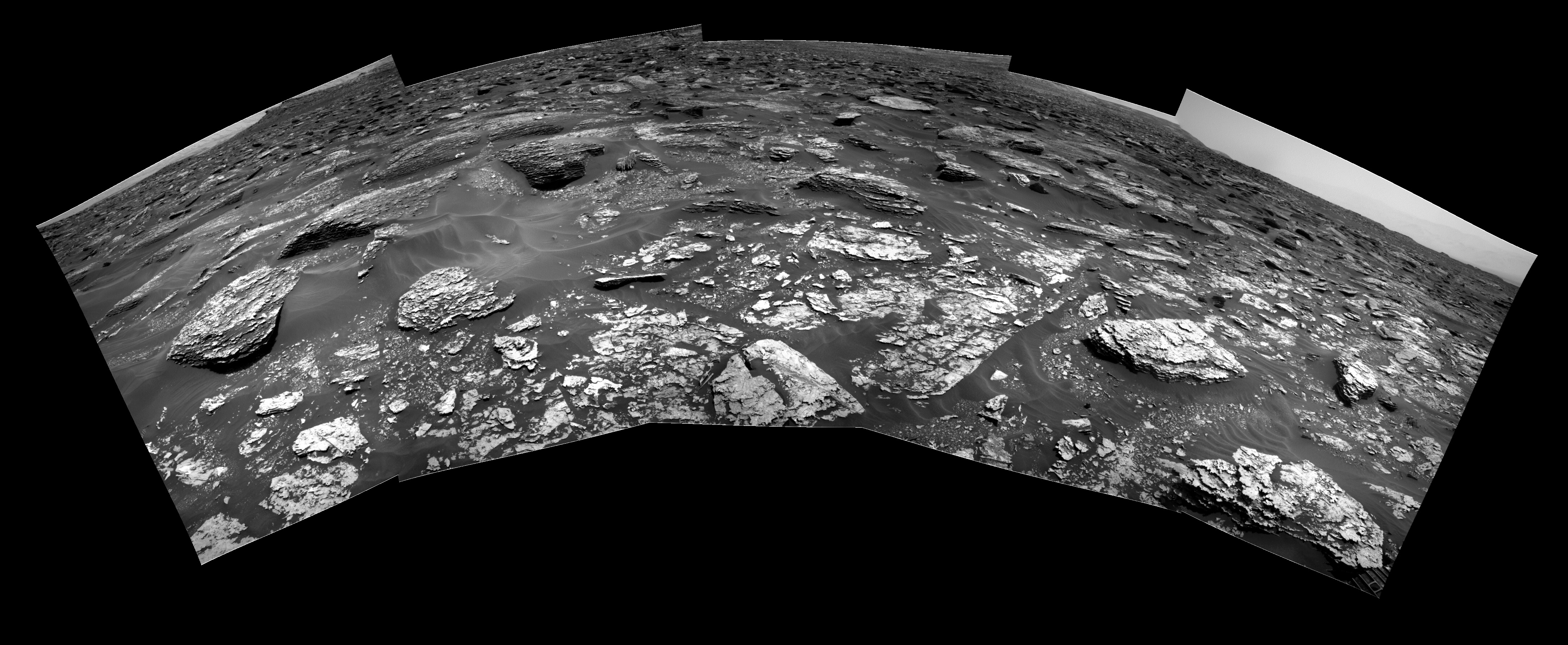
Well, I made another mosaic from the Right Navcam 

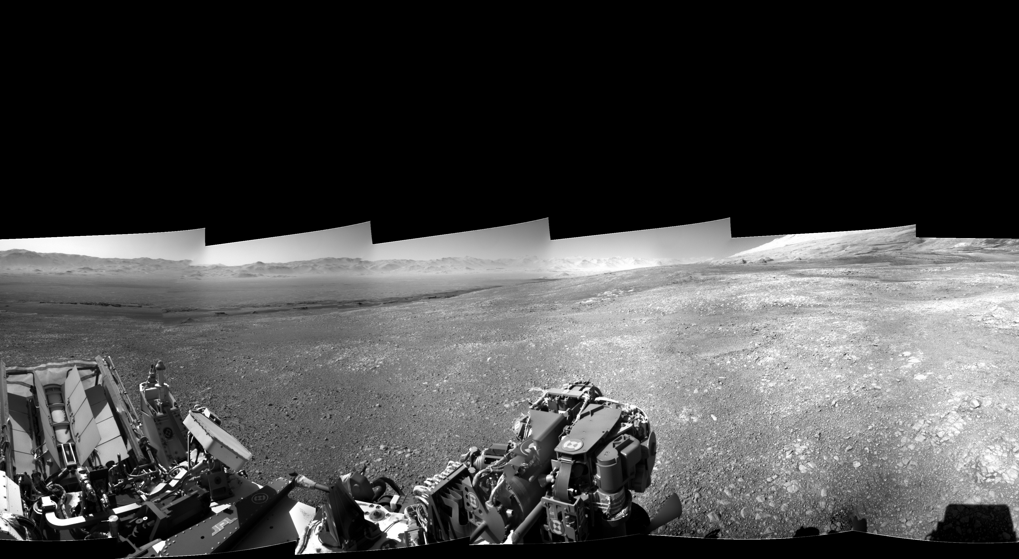
Do you see it? I think it’s very hard to spot.  Look at the top center of the rightmost pane, and the elongated whitish feature is the feature at the center of the Mast Cam mosaic above. If you click the image and enlarge it, you will be convinced.


Mars rock circle in tabloids

A Mars Curiosity image of a “rock circle” has appeared in the British tabloids in the last few days,  touted by “alien hunters” to be an artifact of some kind .

The NY Post gave secondary coverage and carefully stated that it was “recently found” among the images by said “hunters.”

From the setting, I could see that it did not match the recent terrain being covered ( we’re up to sol 1734, ) and I did spend a little time looking back over the route to find a likely spot. I was pretty lucky, although I will credit my intuition, as I found it as a Mastcam image from sol 528

In fact, this image was evidently not a chance acquisition, since they immediately acquired this followup image, also on sol 528

Here we get a more detailed view, and it looks somewhat more “natural”, I think, with noticeable irregularities. Then, on sol 529, they actually “moved in for a look” and acquired this image

Here you can start to get an idea of its formation. It seems to be sort of a disk with the center scoured low, like a lozenge. Of course, this is just one small feature! From what I understand, the landscape as we see it is formed almost exclusively by very slow erosion from the dust storms.

BTW, the images were acquired on 2014-01-30 13:53:37 UTC,  2014-01-30 13:54:26 UTC, and  2014-01-31 15:46:03 UTC, over three years ago.

Also, here is the section of the path showing the location

The “dog-doo”

This is the name which occurred to me when I saw this feature, and true to my habit, I’m sticking with it. Here it is in a sol 1700 Mastcam shot, which I already included in a panorama linked in “Ozymandias”, below.

It does seem to be a distinctive feature. The darker blobby looking rock on the top doesn’t seem to fit with the more predominant thinly layered rock, which are easily seen as eroded remnants of dust-formed strata.

Well, at this point ( sol 1700 ) I had high hopes that Curiosity would make a bee-line for it and do a major examination, but these met with frustration.

Coincidentally, I read at about this time, an ONION article on the “Morbid Curiosity Rover”. Of course this is a pun, and nothing to do with “morbid curiosity”, but a facetious evaluation of  Curiosity’s “morbid” temperament, as note that the official MSL accounts allow for Curiosity to speak in the first person. The Onion found that Curiosity was uncooperative, and even unresponsive, and given to obsessive lingering and drilling activities.

I thought this to be a wry comment on the incompatibility of the inscrutable science campaign with the preferences of those of us more concerned with sight-seeing.

So these thoughts came to the fore as Curiosity roved closer and closer to the “dog-doo”, but seemed to deliberately eschew imagery of it. I thought, and still think, that it was partly because it was up-slope from Curiosity, and the imagery had a tendency to pan on a level plane, so that we were treated to extensive views of “where it had been” but the looming features ahead, including the “dog-doo”, were chopped off at the ankles. ( If you don’t believe me, check it out! )

Well, there were a few Navcam shots, but this feature was obviously not a target, and at closest approach, Curiosity veered to the east, and focused on other things, this to my ultimate frustration, I thought.

But then, there was a late adder to the sol 1726 SUBFRAME products from the Mastcam. These are monochromatic, and have a funky grid superimposed, but OTOH, are highly detailed, and feature a magnificent view of the “dog-doo” at the extreme right.

Accordingly, I offer this truncated version of what is approximately a 180 degree panorama, consisting of  2 of the 20 component images:

In Paint.net, I used just a “tetch” of Gaussian blur ( a minimal setting of 1 ) to alleviate the crosshatching of the “grid”, and gave it a sepia tint, which I modified with a slight reddening of the hue.

“You’re in the shop!”

Where Is Curiosity?

The MSL website helpfully provides maps to show the progress of Curiosity, but lately, circumstances have led to some frustration.

Curiosity has reached the southern limit of the displayed range, and it is heading south, so it is hard to see what is in store. In addition, the large scale inset is placed so that it obscures significant adjacent topography … as shown here …

Never fear! I have the Hiview software and image files, which I downloaded some time ago, and these include the imagery that is the basis for these maps. So here I display a  small scale ( … N.B. a small scale displays a large area … )  image with the approximate boundary of the sol 1707 inset map marked.

You’ll note that the “foothills” of Mt. Sharp are well distant to the south. The features there were evident in the panoramic views from the landing site, as see my  Sol3 panorama  post from Dec 5,2012. ( This was my first Mars Curiosity post. )

Curiosity is more than halfway there from the landing site, but I’m not sure what the schedule is, or the planned path.

“Hills peep o’er hills, and alps on alps arise!”


Ozymandias

The latest vistas from Curiosity put me in mind of Shelley’s sonnet.

“Look on these works, ye mighty, and despair.”

Of course, these are not the ruins of some civilization, but purely inanimate landscape. Yet, everything takes a form through a very leisurely evolution, compared to earth, and there it all sits, like some incredible junkyard.

Here is a simple panorama from the mastcam images of sol 1698.

… click to enlarge!

… Here’s the same scene on sol 1700, except for a forward displacement of Curiosity’s POV.

The very prominent knoll in the left foreground on sol 1700 can easily be located in the left middle ground on sol 1698.

The prominent features from the center to the lower right in the sol 1698 view are no longer in view on sol 1700.

Here’s a sol 1705 Navcam view which can be matched up with the sol 1700 Mastcam view, above.

Curiosity has advanced to a position in the sol 1700 view, just in front of the 3 large “rocks” near the center of that view. This formation appears in the sol 1705 view on the left center. It can be identified by the form of the sand, or dust, drifted against them.


The Martian Tree Stump

The “tree stump” on Mars was in the news this month, and it is indeed an interesting formation, of which there are countless examples in the Curiosity image gallery.  I don’t mind such fanciful descriptions, since it does bring attention to these images, and in fact my attention has flagged badly in the last few years, after having followed them assiduously in the early days.

I still have my PTGui panorama maker, and my “curiosity”, so I followed up on this one.

Since “You’re in the shop” I’ll share a minor glitch which vexed me greatly just yesterday, but today’s a new day and all is well.

I composed the following panorama which contains the frame from the Mast Camera that was publicized as showing a “tree stump”

Of course, it’s missing a piece! This does show that the panorama is composed of 8 separate ( overlapping ) images. But it is certainly a detraction. I spent maybe an hour trying to figure out what was wrong before I went ahead and let PTGui figure it out.

If you “click to enlarge”, then click the “+” to magnify, you will see the whole thing in the resolution of the “stump” panel that was in the news.

Well, then, today I found the following in the Raw image gallery:

So there we have it. ( This is an excerpt with the header note pasted on. ) So of course it was a simple matter to patch in and form the full panorama:

Much better! But what about this “stump” ? I looked for other images, and found the following from sol 1648, whereas this was sol 1647:

This is a panorama of 5 images from the mast cam, in color this time, as they usually are. Curiosity had moved “overnight” and you can see the large “fin” , which is to the right of the “stump” in both images, but this time the view of the “stump” shows lateral extension, indicating that the sol 1647 image was “edge on”.

Never fear, at center bottom we have a cylindrical post with some kind of runic marking! The poetry of Mars is never dead.

Sol 550 : A MAHLI Panorama

Here is a hotlinked sol 549 Navcam image of a small ridge that captured the interest of Curiosity. I think it’s about 2 feet long:

On sol 550 it took a series of MAHLI closeups, and also this Navcam image of the robotic arm ( with the MAHLI on it ) during the process of doing so:

BTW, here is an image which shows the arm in the stowed position, prelaunch:

There are three joints on the arm itself, with all the axes parallel, so it moves in one plane with motion of these three joints. There’s a vertical “post” that carries the arm assembly and allows it to swing out and away from the base. You can see it projecting downward near the left front wheel.

You can also see the name plate on top of the upper beam of the stowed arm, and the forward projecting arm joint at the right side of the rover. These are visible in many of the downward looking Navcam and Mastcam images, including the first image of this post.

If I had understood all this correctly, I never would have made that blooper in my SPOT OF BOTHER post!

Anyway, the MAHLI took a series of images of this little ridge on sol 550, and they appeared to be suitable for a panorama, so I tried it. It worked pretty well, but it is not a true panorama. The images on the left were part of a “scan” where the MAHLI changed position but kept pointing in the same direction, more or less. Then the images at the right were made by swinging the POV outward. It stitches down the centerline pretty well, but you can see some doubling up of particular features above and below. Well, a nice result and it shows incredible detail. As always, CLICK TO ENLARGE!

Looking back at Dingo Gap

Here is a 3 X 4 panorama from Mastcam images acquired on sol 538 around 2014-02-09 22:37:19 UTC. (Click to enlarge ! )

Compare the near horizon with this view from the landing site on sol 3:

You can see the same mesa-like structures on the lower reaches of Mount Sharp, and the same low dome to the left of them. Note that the gap between the mesas has opened up from the new position, as Curiosity has moved back and to the right from this sol 3 POV.

Finally, this animated gif is from the Rear Hazcam on sol 538, with images acquired at 2014-02-09 22:03:32 UTC, 2014-02-09 22:56:48 UTC, and 2014-02-10 00:37:23 UTC, so the second of these seems to be the POV of the Mastcam panorama. Note the dome of Mount Sharp visible in the first frame. … A very nice shot!

A spot of bother

As publicized, it appears Curiosity has made its move to traverse the rather striking looking sand bar at Dingo Gap. However, it looks like it is hung up a little. The panorama below, made from sol 533 Mastcam images, shows that the stowed robotic arm, with the nameplate on it, has touched the sand on the far side of the dune, which is just a few feet across here.


BTW, to make this panorama “stitch” I had to manually add control points by matching the tiny pebbles in the sand, so I’m quite proud of myself!

UPDATE: This “hangup” is just an illusion caused by the featureless sand background. The appearance I mistook for marks in the sand is actually strapping holding the nameplate to the round support arm. The support arm itself has the appearance of a shadow on the sand leading to my erroneous “gestalt” perception.

Here is a Navcam view from the same position which has a similar appearance, but in this case we can see that the drill bit holder ( attached to the front of Curiosity ) is beneath the nameplate, so the nameplate and arm are well clear of the sand.

… END UPDATE
Here is an animated gif from the sol 533 Front Hazcam images showing the approach to the crest of the dune.

The Mastcam panorama was taken around 2014-02-04 18:37:37 UTC whereas the last frame of the gif was at 2014-02-04 18:07:27 UTC, and the sol 534 Front Hazcam view is unchanged from sol 533, so I’m not sure how that works out.

… well, this just in: According to the sol 535 Front Hazcam view, shown here as an anaglyph, it looks like Curiosity has cleared Dingo Gap!

I’m not sure they’ve reached the promised land of no rocks, though.

Wheel check sol 513

On sol 513 Mars Curiosity used its MAHLI to take a set of 23 closeups of the undercarriage, i.e. the wheels. It seems to be a set of 24 with one missing. There are 6 views, 3 on each side, each repeated 4 times in different positions. Here is an animated gif made of 4 sets of 2 stitched images. I think it’s just good enough to give the effect of rolling. ( Click to enlarge ! )